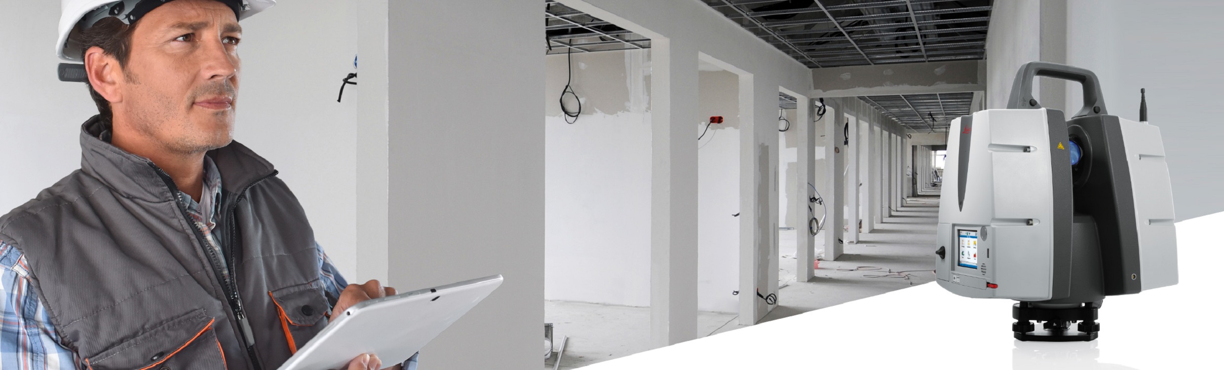
Leica ScanStation P30 / P40 - High-Definition 3D Laser Scanning Solution
เป็นเครื่องสแกนเนอร์ 3มิติ ความละเอียดสูง มีรัศมีการสแกนปานกลาง เหมาะสำหรับงานสแกนอาคาร โรงงาน โครงสร้างพื้นฐาน ถนน อุโมงค์ สะพานหรืองานอื่นๆ ที่ต้องการข้อมูลสแกนที่มีความถูกต้องสูงระดับมิลลิเมตร โดยตัวเครื่องมีระบบชดเชยระดับแบบ 2 แกน ช่วยปรับแก้ค่าระดับของข้อมูลสแกนทุกจุดในระหว่างทำการสแกน สามารถใช้งานทั้งภายในและภายนอกอาคาร มีความทนทานต่อฝุ่นละอองและน้ำตามมาตรฐาน IP54 อุณหภูมิการปฏิบัติงานระหว่าง -20 – 50 °C มีฟังก์ชั่นการสแกนแบบงานสำรวจได้แก่ Quick orientation, Set azimuth, Known backsight, Resection, Auto resectionและ Traverse เทคโนโลยีในการรังวัด Ultra-high speed time-of-flight enhanced by Waveform Digitizing (WFD) ระดับของแสงเลเซอร์ ระดับ1 มีความปลอดภัยสูงไม่เป็นอันตรายต่อดวงตาและผิวหนัง
คุณสมบัติ Leica P40/P30
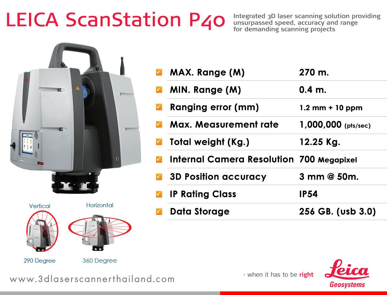
• ระยะการสแกน Leica P30 0.4 – 120 เมตร / Leica P40 0.4 – 270 เมตร
• อัตราการสแกนสูงสุด 1ล้านจุดต่อวินาที
• ความถูกต้องของระยะ 1.2 + 10 ppm
• ความถูกต้องเชิงมุม 8 พิลิปดา
• ขอบเขตการสแกน แนวราบ 360° แนวดิ่ง 290°
• ระบบชดเชยแกนกล้อง แบบ 2แกน มีช่วงการชดเชย +/- 5ลิปดา ความถูกต้อง 1.5 พิลิปดา
• ระบบเก็บข้อมูล solid-state drive (SSD) 256GB ภายในตัวเครื่อง หรือ USB
• การควบคุมสั่งงาน หน้าจอสีสัมผัส พร้อมปากกา Stylus และการควบคุมผ่านอุปกรณ์พกพาแบบไร้สาย
• กล้องเล็งหัวหมุด Laser plummet
• กล้องถ่ายภาพ HDR ความละเอียดภาพPanoramic 700 megapixels ติดตั้งภายในตัวเครื่อง
• แบตเตอรี่ แบบภายในใช้งานได้ 5.5 ชั่วโมง
• อุณหภูมิการใช้งาน –20°C to +50°C
• IP Rate IP54
• ฟังก์ชั่นการสแกน Quick orientation, Set azimuth, Known backsight, Resection, Auto resectionและ Traverse
Integrated 3D laser scanning solution providing unsurpassed speed, accuracy and range for demanding scanning projects
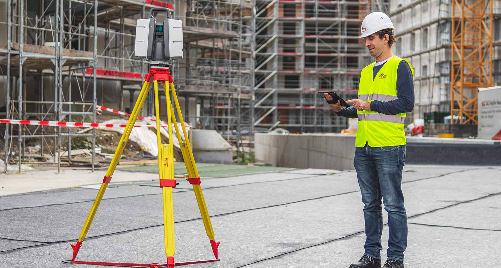
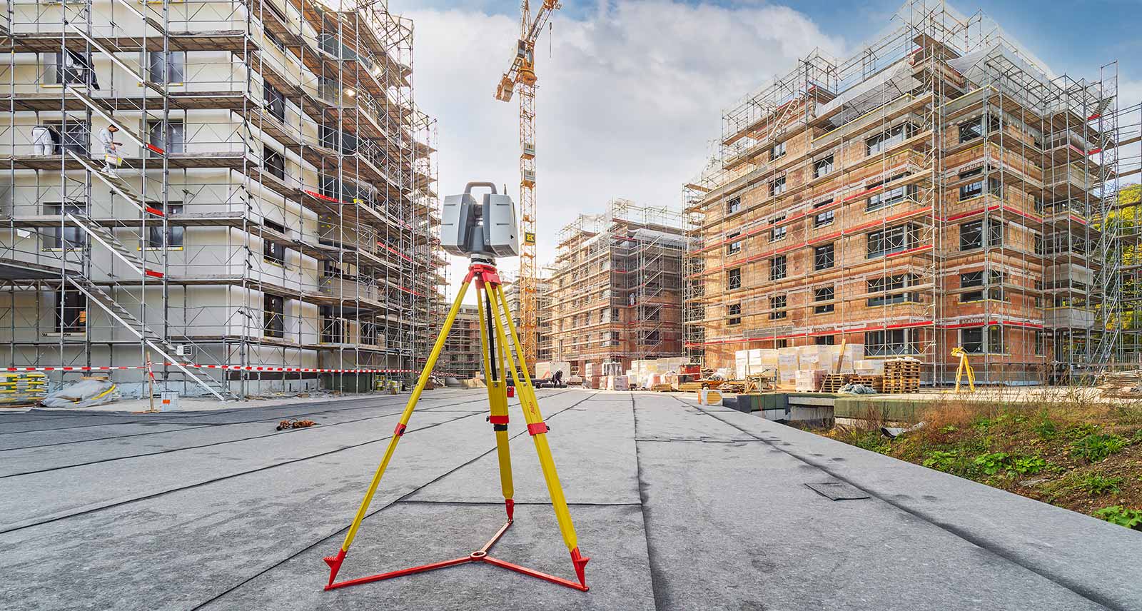
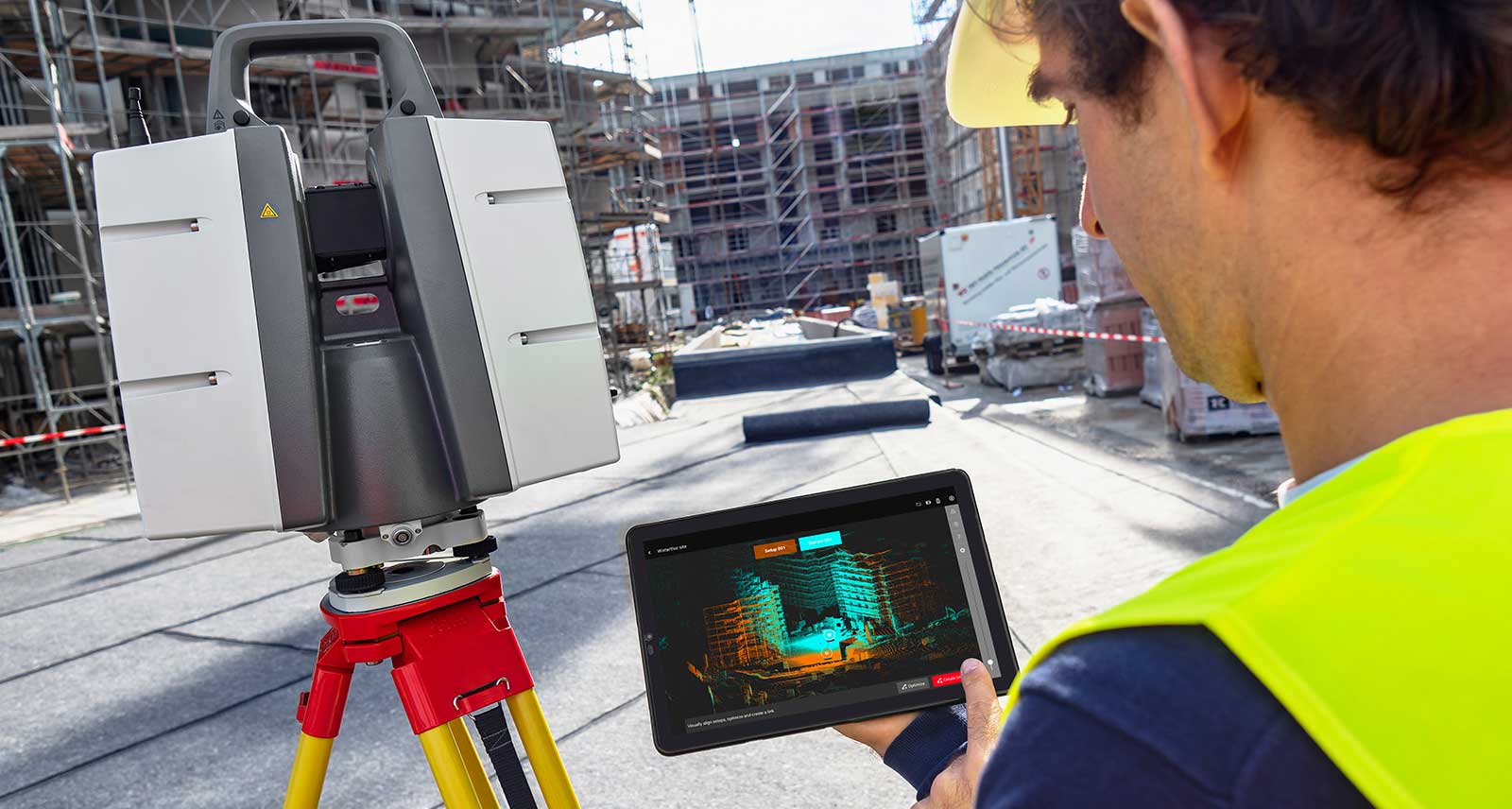
Leica ScanStation P-Series 3D laser scanners are your perfect partner when capturing 3D geometry of civil infrastructure, creating an as-built representation of a large industry complex, reconstructing a crime scene or generating 3D data for integration into Building Information Modelling (BIM). As part of the Leica Geosystems 3D Reality Capture solution, the Cyclone FIELD 360 app now links the 3D data acquisition in the field with the ScanStation P-Series laser scanner and final data registration in the office with Cyclone REGISTER 360. One-site, users can now automatically capture, register and examine scan and image data.
Leica ScanStation P-Series 3D laser scanners are your perfect partner when capturing 3D geometry of civil infrastructure, creating an as-built representation of a large industry complex, reconstructing a crime scene or generating 3D data for integration into Building Information Modelling (BIM). As part of the Leica Geosystems 3D Reality Capture solution, the Cyclone FIELD 360 app now links the 3D data acquisition in the field with the ScanStation P-Series laser scanner and final data registration in the office with Cyclone REGISTER 360. One-site, users can now automatically capture, register and examine scan and image data.
Leica ScanStation P30/P40 deliver highest quality 3D data and High-Dynamic Range (HDR) imaging at an extremely fast scan rate of 1 million points per second at ranges of up to 270m. Unsurpassed range and angular accuracy paired with low range noise and survey-grade dual-axis compensation form the foundation for highly detailed 3D colour point clouds mapped in realistic clarity.
Leica RTC360 3D Reality Capture Solution
The right choice
Whether you need a detailed as-built representation of a façade, a 2D floor plan, 3D data for integration into Building Information Modelling (BIM), capturing 3D geometry of roads, rails, tunnels and bridges or high-definition scan data for topographic maps and as-built surveys, you know you’ll need an accurate long range scanning tool for your projects – the ScanStation P30/P40 laser scanners from Leica Geosystems are the right choice, because every detail matters.
High performance
Reducing downtime, the extremely durable 3D laser scanners perform even under the toughest environmental conditions, such as extreme temperatures ranging from – 20°C to + 50°C and comply with the IP54 rating for dust and water resistance.
Complete scanning solution
Leica Geosystems offers the Leica ScanStation portfolio as an integrated part of a complete scanning solution including hardware, software, service, training and support. 3D laser scanner data can be processed in the industry’s leading 3D point cloud software suite, which consists of Leica Cyclone stand-alone software, Leica CloudWorx plug-in tools for CAD systems and the free Leica TruView.

ScanStation P30/P40 delivers
Highest quality 3D data and HDR imaging
Extremely high speed scan rate of 1 mio points per second
Ranges of up to 270 m
Low range noise
Survey-grade dual-axis compensation
Highly detailed 3D colour point clouds mapped in realistic clarity
-
Phone Number
084-682-1041 -
Email Address
info@jitjai.co.th -
Address
1/285 4th Floor Moo.9 Bangphut,Pakkred, Nonthaburi 11120 THAILAND